
Currently Empty: $0.00


9.4 Recorded Plat Method
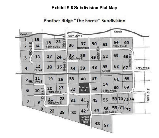
9.4 Recorded Plat Method (Lot & Block System)
The recorded plat method is used for properties in subdivisions. Land is surveyed and divided into lots (and sometimes blocks), then mapped on a subdivision plat. The plat map is recorded in the county, and lot/block numbers become the legal description.
- Common for residential, commercial, and industrial subdivisions.
- Plat must comply with local standards and be officially recorded.
- The full legal description includes lot, block, subdivision name, section, township, county, and state.
Example: “Lot 7, Block 8 of the Panther Ridge, the Forest Subdivision of the SE 1/4 of Section 35, Township T28S, R19E of the Tallahassee Principal Meridian in Manatee County, Florida.”
Check-In Questions
- What does the recorded plat method use to describe property?
Show Answer
Correct Answer: Lot and block numbers from a subdivision plat map - What must a recorded plat legal description include?
Show Answer
Correct Answer: Lot, block, subdivision, section, township, county, and state